The dam-free micro-hydro feasibility study identified three possible project sites, one at each of the three waterfalls on Bard’s property. All three provide about the same amount of water flow but significantly different elevation changes and settings. If you haven’t, read about the Motivation and Objectives of this project.
Location
The Saw Kill (east of the Hudson River) is a small stream located in Dutchess County, NY, and runs through the towns of Red Hook, Tivoli, and Milan. The Saw Kill is 14.3 miles long and empties into the Tivoli South Bay, part of the Hudson River National Estuarine Research Reserve. The potential project area of the Lower Saw Kill is the lowest 0.81 stream miles of the Saw Kill, from the mouth (South Bay) to Annandale / River Road Bridge (the bridge crossing the Saw Kill towards Annandale-On-Hudson).

To get a better feel for the distances within this stream stretch, have a look at the following table:

And because images always help us visualize sites here are two pictures of Bard’s dams (the last time before we will only look at pictures of waterfalls – without dams).

taken from Fuss & O’Neill, Dam Removal Feasibility Study, Oct 2016

Environmental Setting
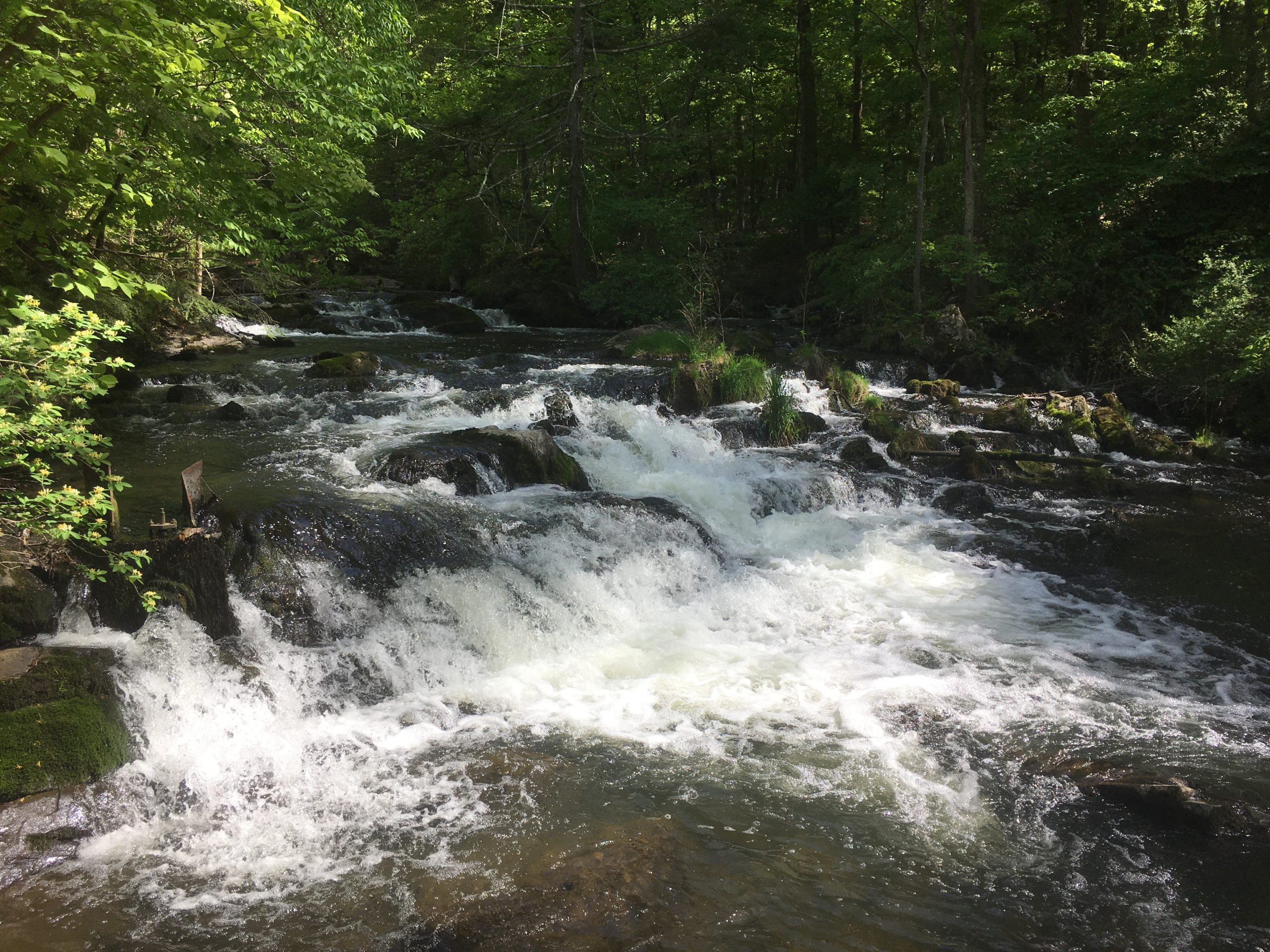
Kiviat, Stevens, and Schmidt, 2017[1] described the environmental setting of Lower Saw Kill in detail. They summarize the overall habitat assessment as “Disturbed cool ravine with a mixture of good quality native species and disturbance indicator native and nonnative species (plants). Animals of cool ravines are also represented, especially winter wren, as well as riparian species such as Louisiana waterthrush.”
Abundant mosses and sparse vascular plants on rocks. The largest (lowest) waterfall is just above tidewater and below the lower dam. A smaller fall (next-lowest falls) is just above the impoundment of the lower dam (just above the old swimming pool now mushroom farm), and smaller falls are located between there and Annandale. The waterfalls, and small rock outcrops in the streambed, are graywacke, a dark gray, carbon, and calcium-rich sandstone that is relatively resistant to geological erosion and underlies many of the high spots in the landscape. Beds of graywacke and gray shale alternate, with the shale more readily eroded and often not visible. Although these beds of sedimentary rock were deposited in a more-or-less horizontal position, folding and faulting have tilted and broken the beds, resulting in the waterfall and ledge features […].
Kiviat, Stevens and Schmidt, 2017: Biological Surveys of the Saw Kill from Route 9G to South Bay, Town of Red Hook, Dutchess County, New York.
Everyone who is interested in more details about their ecological assessment of the stream channel, ponded shallows, soil banks, bedrock outcrops, tidewater and the fishes in between the falls, dams and the mouth and much more should check out their report (see footnote).
History of Hydropower
The early development of saw and grist mills using hydropower along the Saw Kill provided an impetus to settlement. Dutchess County saw rapid agricultural expansion starting in 1750 when sawmills and grist mills were built. Three mills had been built along the Saw Kill by 1797: a grist mill on the lower falls (Lowest Waterfall), a saw-mill at the second falls, and another grist mill at the location of the Annandale Dam. Other mills developed along the Saw Kill, but by the end of the 19th century, most mills had gone out of business due to economic shifts and more modern industrial mills. Some of these mills were also burned by the British in 1777. [2]

Montgomery Place Estate installed hydroelectric power generation 1923 at the Lower Saw Kill Dam. The power was utilized at the Estate as well as within the hamlet of Annandale. Montgomery Place decommissioned the facility during a drought in the mid-1960s and connected to the public electrical grid.
As part of the Saw Kill Project, the project Team looked at refurbishing the historic system but ultimately decided against it. What that system was supposed to look like and why we decided against it, you will find out in our next post.
[1] Source: Kiviat, Stevens and Schmidt, 2017: Biological Surveys of the Saw Kill from Route 9G to South Bay, Town of Red Hook, Dutchess County, New York.
[2] The Pragmatic Picturesque at Cedar Hill, Source: https://bardcollege.maps.arcgis.com/apps/Cascade/index.html?appid=07b07fa5faca4e17af46b2fb08a31261

One response
[…] as possible while using only a fraction of the Saw Kill’s water. To learn more about the Saw Kill setting have a look at our previous […]